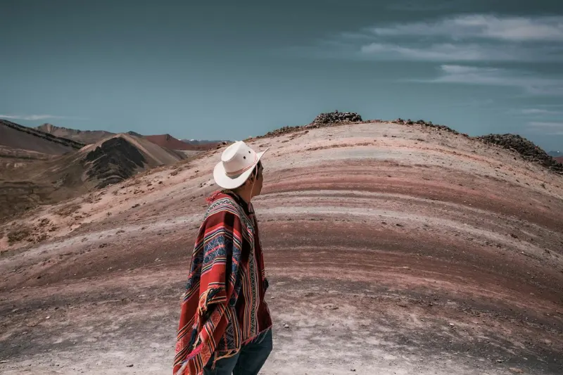
Red yellow green purple across a Peruvian mountainside, looks like spilled paint on a massive scale. Rainbow mountain peru buried under glacial ice for centuries, nobody outside local Quechua communities knowing it existed. Around 2015 the ice melted and the colors just showed up underneath.
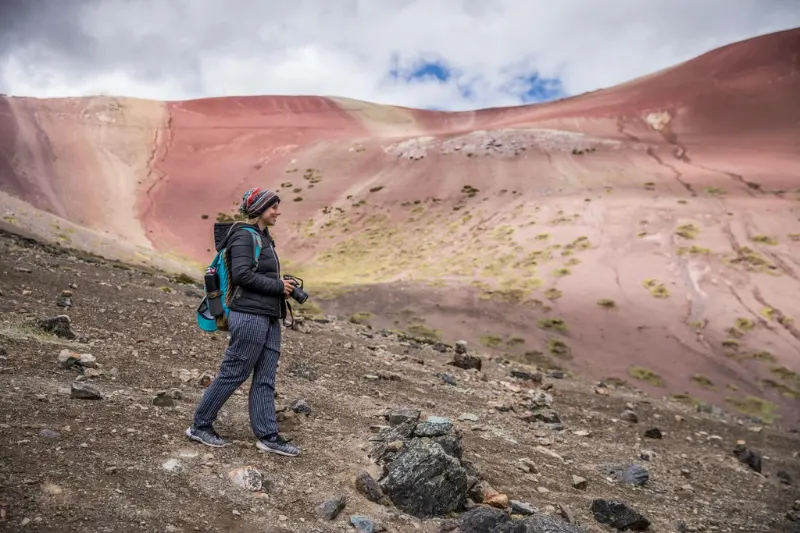
Social media makes the Photoshop question fair. Rainbow mountains real, mineral bands sitting exactly where photographs show them, just more pastel and earthy in person than any viral image suggests. Brick reds, mustard yellows, dusty pinks, seafoam greens, that’s what’s actually there before anyone touches a slider.
Science, routes, altitude, planning all here. Nothing extra.

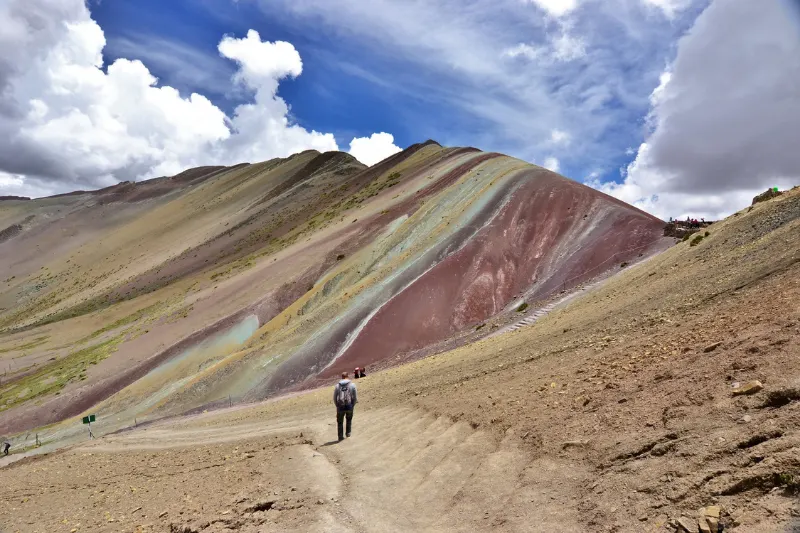
Where is rainbow mountain in peru is the first search most people run after seeing the photographs. Officially Vinicunca, locally Montaña de Siete Colores, roughly 100 kilometers southeast of Cusco. Summit at 5,200 meters, number that matters the moment boots actually hicusct the trail.
Where are the rainbow mountains globally gets asked too. China’s Zhangye Danxia Landform has similar striped landscapes at considerably lower altitude, Peru’s version different through breathtaking elevation and Quechua cultural history running deep into these mountains. That combination doesn’t exist anywhere else.
The vinicunca rainbow sits within the Ausangate mountain region, sacred landscape and genuinely one of the most rewarding things to do in Cusco for travelers willing to wake up before dawn. Treating it purely as a backdrop misses why the place matters to people living near it.
Over 24 million years ago this area was flat, covered by oceans, lakes, rivers carrying distinct mineral loads into basins across countless millennia. Climate changing from era to era changed what got deposited each time, heavy water weight compressing those sediments into solid rock. Foundation of everything visible on the surface today.
Flat horizontal layers explain the stripes but not why they run diagonal and vertical on the mountain. South American tectonic plate constantly colliding with the Nazca plate forced the earth’s crust to buckle fold thrust upward. Ancient seabed lifted into sky, mineral layers tilted sideways, colorful bands exposed to weathering and view at the same time.
The science behind Vinicunca’s color comes down to specific minerals hitting oxygen and water across millions of years. Viniccunca layers produced the palette visible today through chemical reactions that kicked in once those layers hit open air:

5,200-meter colored mountain undiscovered until 2015 sounds impossible until the reason lands. Glacial permafrost covered this peak entirely for centuries, communities below seeing only another snow-capped ridge above them. Viniccunca in the indigenous language means “narrow neck,” zero reference to color because color wasn’t visible from anywhere below.
Temperature rises across the late 20th and early 21st centuries melted that glacier faster than anyone tracked carefully. Early 2010s snow receded completely, vibrant striped earth appeared underneath, photographs hit social media, tourism arrived almost instantly. Unknown destination to 1,500 daily visitors within a few years, economic shift nobody in those villages saw coming.
Real economic boost for those communities, tourism revenue changing daily life in places with almost no outside income before any of this happened. Warning sitting inside that same story just as real though, Andean glaciers being the primary fresh water source for millions of South Americans. What’s happening to those glaciers isn’t just a tourism story.
Mountain and its stripes completely real, anyone booking a rainbow mountain tour needs to know that before expectations get built from social media alone. Distinct mineral bands exactly where the photographs show them, geology doing everything the science section describes. Social media drags saturation to maximum, turning earthy pastels into electric neon the actual mountain simply doesn’t produce.
Sunny day versus cloudy day changes the whole appearance dramatically, direct sunlight making colors pop against blue Andean sky, overcast turning everything to brownish tones, snow covering the colors entirely. Understanding Cusco in every season matters here because the mountain looks genuinely different depending on when someone visits. Conditions that specific day matter more than anything chosen months in advance.
Boosting vibrance and clarity captures natural mineral contrast without turning the landscape into a cartoon. Heavy saturation filters produce viral images, not the actual rainbow mountains standing in front of the camera on any given morning up there.

Two main options, genuinely different travelers choosing each one. The Palccoyo vs Vinicunca debate isn’t about which is objectively better, it’s about what someone actually wants from the day. Neither route wins across the board for everyone.
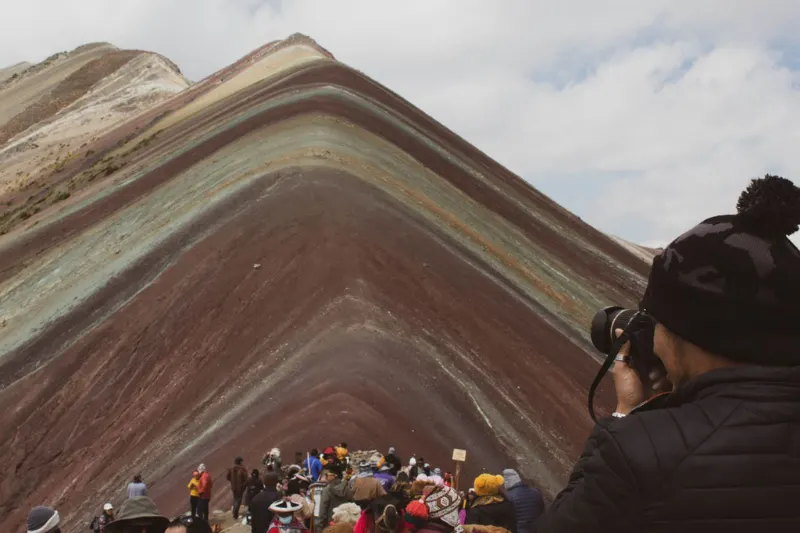
Tour rainbow mountain Vinicunca leaves Cusco between 3am and 4am, three-hour drive, four-kilometer trail each way starting at 4,600 meters. Final push steep and punishing, air at roughly 50% of sea-level oxygen, up to 1,500 people daily during peak season. Optional Red Valley detour adds thirty minutes for a surreal crimson landscape most people don’t regret. Quick comparison between both routes:
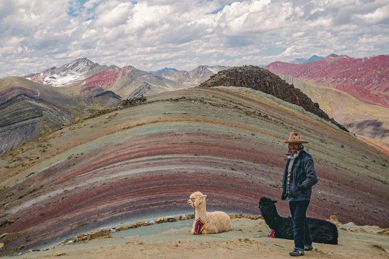
Tour rainbow mountain Palcoyo sits in the same mountain range at slightly lower elevation around 4,900 meters, forty-five minute hike on a gentle flat trail. Palcoyo mountain shows three distinct rainbow mountains rather than one peak, stone forests of jagged rock formations throughout. Fraction of the Vinicunca crowd, genuine quiet consistently available. What makes Palccoyo stand out:
Altitude sickness the single biggest obstacle on either route, symptoms including severe headache, nausea, dizziness, shortness of breath. Knowing how to beat Cusco altitude sickness before the trek starts is mandatory, not optional. These steps make a measurable difference once someone’s actually on the mountain:

Dry season May through October the universal best window for rainbow mountains visibility. Clear sunny skies ensuring excellent color visibility, downside being bitter cold with morning temperatures dropping well below freezing in June and July. Peak tourist season with maximum crowds running through this same window. Simple breakdown:
Wet season November through April brings heavy Andean rainfall, muddy trails, overcast skies muting everything. Precipitation at 5,200 meters falls as snow covering the stripes entirely, common disappointment for wet season visitors who didn’t check conditions. Worth serious thought before booking any rainbow mountain tour during those months.
April and November shoulder months can deliver clear skies with warmer temperatures and fewer crowds. Weather unpredictability increases during transition periods, most operators aiming for summit arrival by 9am to 10am. Andean afternoon clouds turn conditions fast and eliminate visibility the whole trip was built around.
Pre-dawn freezing darkness to blazing high-altitude sun within the same morning on either rainbow mountain peru route. Layering the only strategy handling the full range without freezing at the trailhead or overheating on the climb. Getting this wrong is immediately obvious once the hike starts.
Essential packing checklist for the rainbow mountains trek:
Tourism explosion around rainbow mountain peru brought real economic prosperity to local Quechua communities of Pampachiri, Pitumarca, and Cusipata. Environmental strain followed that same explosion, threatening the landscape drawing visitors in. Ecosystem fragile, mineral surface layer damaging permanently under heavy foot traffic when boundaries get ignored.
Responsible tourism non-negotiable here. The Apus of Cusco are sacred mountain deities protecting local communities and providing water, reverence implied isn’t theatrical or optional for people passing through on a day trip:
Money going to local vendors, fees, guides and drivers means communities managing this landscape actually benefit. The vinicunca rainbow ecosystem depends on visitors treating the place with the respect locals extend to sacred mountain territory. Future generations seeing the same colors requires present visitors staying on the marked path.

Rusty reds of iron oxide, bright yellows of sulfur, earthy greens of chlorite clay, story of ancient seas, violent tectonic collisions, relentless weathering across millions of years sitting right there on the surface. Rainbow mountains aren’t a backdrop, they’re a geological textbook written into the earth. Visible from the trail without any excavation needed.
Classic vinicunca rainbow route or peaceful panoramic Palccoyo alternative, witnessing the painted hills of the Andes stays with people differently than most travel experiences manage. Science behind the stripes, altitude reality, cultural context of sacred mountain territory, all of it transforms sightseeing into something carrying actual weight.
The rainbow mountain tour connects to something genuinely profound, what geological time and natural process look like when the ice finally moves out of the way. Happened around 2015, world showed up almost immediately, window to experience it before it changes further still open right now.